TN FOREST AT A GLANCE
TN FOREST AT A GLANCE
Tamil Nadu, the Southernmost State of the country has a geographical area of 1,30,060 sq km which is 3.96% of the total geographical area of India. The State is endowed with rich biodiversity, from marine coastal systems in the Gulf of Munnar to the terrestrial evergreen forests in the Western Ghats and temperate forests in the hilly regions. As per the Champion & Seth Classification of Forest Types (1968), the forests in Tamil Nadu belong to nine Forest Type Groups, which are further divided into 39 Forest Types. The Nilgiri Biosphere Reserve represents a unique and threatened ecosystem in the tropics inside the Western Ghats Mountain system and is one of the biodiversity hotspots. Tamil Nadu has been a pioneer State in the biodiversity conservation, particularly in Protected Area management, including conservation of marine fauna. Tamil Nadu is famous for its Teak and Sandalwood forests. Plantations of Sandalwood, conservation and management of mangroves and wetlands are a priority area of the SFD. Recorded Forest Area (RFA) in the State is 22,877 sq km of which 20,293 sq km is Reserved Forest, 1,782 sq km is Protected Forest and 802 sq km is Unclassed Forests. In Tamil Nadu, during the period 1st January 2015 to 5th February 2019, a total of 542.40 hectares of forest land was diverted for non-forestry purposes under the Forest Conservation Act, 1980 (MoEF & CC, 2019). As per the information received from the State during the last two years, 74,030 ha of plantations were raised in the State. Five National Parks, 29 Wildlife Sanctuaries and two Conservation Reserves constitute the Protected Area network of the State covering 4.97% of its geographical area. Mukurthi National Park, is famous for Nilgiri Thar.
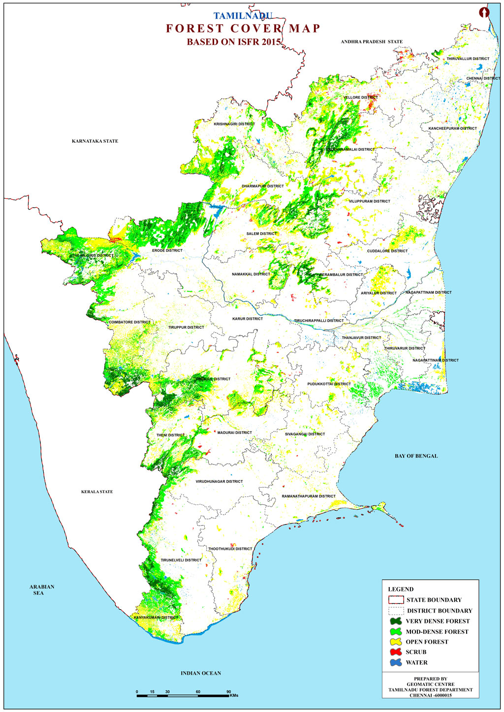
Based on the interpretation of IRS Resourcesat-2 LISS III satellite data of the period Oct 2017 to Aug 2018, the Forest Cover in the State is 26,364.02 sq km which is 20.27 % of the State's geographical area. In terms of forest canopy density classes, the State has 3,605.49 sq km under Very Dense Forest (VDF), 11,029.55 sq km under Moderately Dense Forest (MDF) and 11,728.98 sq km under Open Forest (OF). Forest Cover in the State has increased by 83.02 sq km as compared to the previous assessment reported in ISFR 2017. The State has reported extent of recorded forest area (RFA) 22,877 sq km which is 17.59% of its geographical area. The reserved, protected and unclassed forests are 88.70%, 7.79% and 3.51% of the recorded forest area in the State respectively. However, as the digitized boundary of recorded forest area from the State covers 21,653.95 sq km.
The State has reported extent of recorded forest area (RFA) 22,877 sq km which is 17.59% of its geographical area. The reserved, protected and unclassed forests are 88.70%, 7.79% and 3.51% of the recorded forest area in the State respectively. However, as the digitized boundary of recorded forest area from the State covers 21,653.95 sq km. (ISFR,2019)
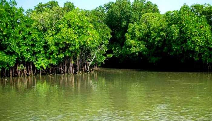
MANGROVE COVER
DISTRICT WISE MANGROVES COVER (AS PER ISFR 2019 ASSESSMENT)
| Districts | Very Dense Mangrove | Moderately Dense Mangrove | Open Mangrove | Total |
|---|---|---|---|---|
| Cuddalore | 0.00 | 7.05 | 0.68 | 7.73 |
| Nagapattinam | 0.00 | 1.10 | 1.95 | 3.05 |
| Pudukkottai | 0.67 | 0.46 | 0.77 | 1.90 |
| Ramanathapuram | 0.37 | 0.71 | 1.26 | 2.34 |
| Thanjavur | 0.00 | 8.96 | 3.29 | 12.25 |
| Tiruvallur | 0.00 | 0.00 | 0.91 | 0.91 |
| Tiruvarur | 0.00 | 8.11 | 4.74 | 12.85 |
| Thoothukudi | 0.00 | 0.85 | 2.95 | 3.80 |
| Total | 1.04 | 27.24 | 16.55 | 44.83 |

ALTITUDE-WISE FOREST COVER OF TAMIL NADU (AS PER ISFR 2019 ASSESSMENT)
| Area in sq.km | ||||
|---|---|---|---|---|
| Altitude Zone | VDF | MDF | OF | Total |
| 0-500 | 376 | 5,121 | 8,586 | 14,083 |
| 500-1000 | 1,810 | 4,398 | 2,411 | 8,619 |
| 1000-2000 | 1,087 | 1,394 | 697 | 3,178 |
| 2000-3000 | 332 | 117 | 35 | 484 |
| VDF - Very Dense Forest; MDF – Moderate Dense Forest; OF – Open Forest | ||||
FOREST COVER IN HILL DISTRICTS
FOREST COVER IN TRIBAL DISTRICTS
TREES OUTSIDE THE FOREST (TOF)
| Forest cover outside the Recorded Forest Areas (in sq. km.) | Tree cover (in sq. km.) | Extent of TOF (in sq. km.) |
|---|---|---|
| 8775 | 4830 | 13605 |
FOREST COVER MAP OF TN


